




Associate Professor Tatsuto Aoki and Hayashi Kiyomi of the Faculty of Regional Development Studies Studies, Institute Institute of Human and Social Sciences, Kanazawa University, as members of a research group consisting of Hyogo University of Teacher Education, Ritsumeikan University, Okayama University, University of Tokyo, Fukuoka University of Education, Tohoku University, University of Tsukuba, and Kanazawa University, measured the changes in the topography caused by the 2024 Noto Peninsula earthquake and released them as high-resolution 3D data.
The research group acquired high-definition 3D data of coastal landforms, mainly those uplifted by the 2024 Noto Peninsula earthquake, using a UAV. Using the accumulated high-definition 3D data, the group created educational materials (3D models, panoramas viewable with smartphones, and 3D prints) that can be used for geography education, etc., and made them available on the web. (*For details of the publicly available data, please click the link "Click here to see the press release" at the bottom of this page.)
Furthermore, using the created teaching materials, we conducted teacher training for elementary school teachers in Wajima City in November 2024, and organized measures to support learning of environmental education and disaster prevention education, as well as the usability and applicability of the teaching materials.
We believe that the high-definition 3D data acquired by this research group will be widely used not only by researchers but also by others, and will serve as a foundation for the development of basic research and reconstruction efforts. We also believe that the educational materials we have created can be a tool for education and outreach activities, including geography and geoscience education, to provide an accurate picture of the current situation in the disaster-affected areas.
The results of this research were published in the "Journal of Disaster Research", an international English-language journal of disaster science, on August 1, 2025.
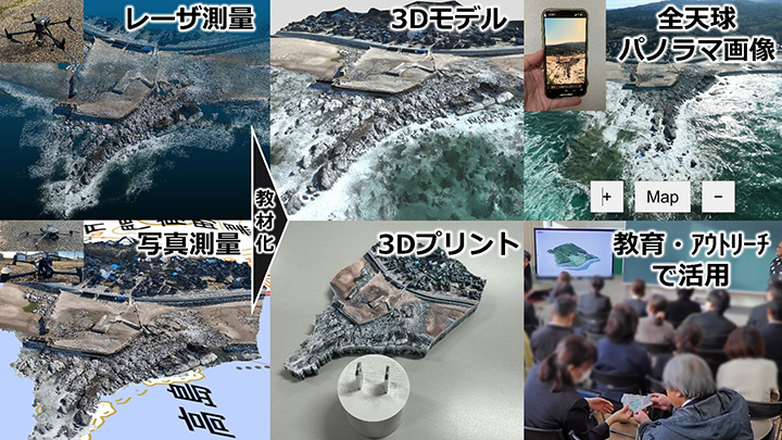
Figure 1 : High-resolution 3D data acquired in this study, teaching materials created and examples of use (Geographical Survey Institute map published by the Geospatial Information Authority of Japan was used for the background map)
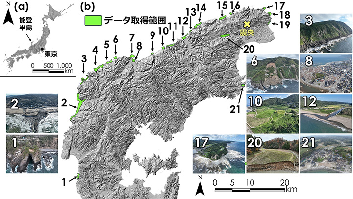
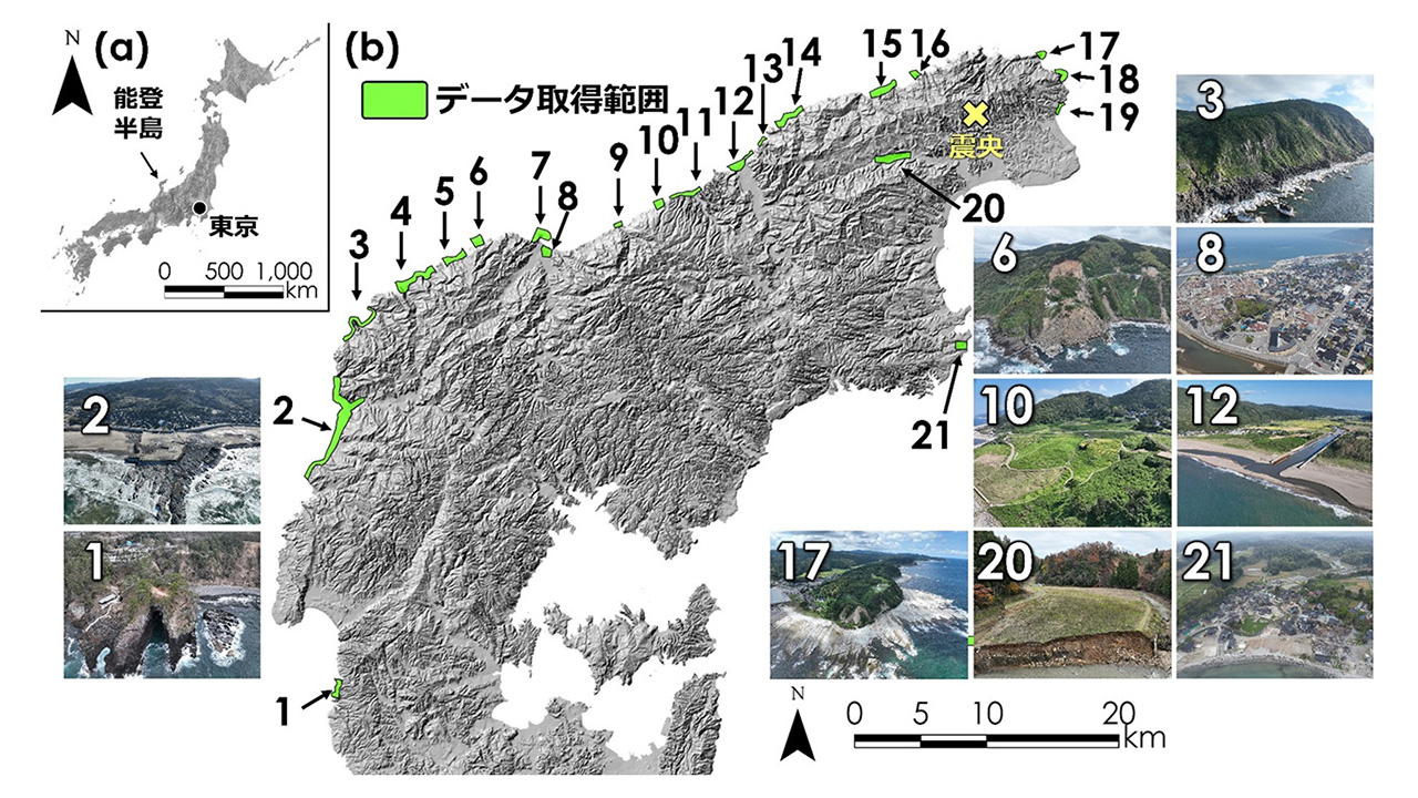
Figure 2 : List of locations where high-definition 3D data was acquired in this study
Click here to see the press release【Japanese only】
Journal : Journal of Materials Research and Technology
Researcher Information : Tatsuto Aoki
Kiyomi Hayashi
Related Information
School of Regional Development Studies, College of Human and Social Sciences, Kanazawa University : https://chisou.w3.kanazawa-u.ac.jp/en/
Graduate School of Human and Socio-Environmental Studies, Kanazawa University : https://human-socio.w3.kanazawa-u.ac.jp/en/
 PAGE TOP